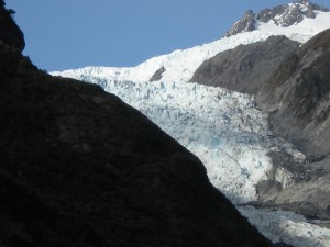
After months of a travel speed that can only be described as terribly casual, we flew up the west coast. Early to rise at our possum hunter’s camp, we bid Josh adieu and made to Fox Glacier at sun up. We beat all the tourists and had the half-hour stroll up the moraine to ourselves! Although we couldn’t get terribly close, the glacier impressed us! Then we were on to Franz Glacier where it was more of the same plus a few bus loads of Asian tourists. Personally, I prefer to see glaciers in the majestic solitude of the silent mountains, versus the Disney-fied setting, but still gorgeous!
Hokitika was our lunchtime stop where we strolled the streets, admired their historic buildings, puzzled over the machines at the sock making museum, and got info about shower opportunities. They pointed us up the road to Greymouth, where the aquatic center offered locker room use for $5.50. When you haven’t showered for days (a week?!), it’s hard to complain even about showers that operate in 90 second bursts after pressing a button. Ahhhh!!
Most of our evening was spent attending to laundry at a strange facility in a parking lot cum RV park behind a gas station. The residents kept coming into the tiny room to use the toilet — weird! Then we scouted wi-fi, and followed up our finds in the morning for my weekly chat with my lovely CASA girl. We spent the best hours of the day climbing the very steep Arthur’s Pass, rubbernecking a brutal accident from the day before, passing under a waterfall that had been re-routed OVER the highway, and stopping for the view from DEATH’S CORNER! (Seriously? This is a highway, you official naming people. What are you thinking?).
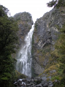
Once in the town of Arthur’s Pass, we found the DOC (Department of Conservation) Visitor’s Center staff to be lovely and not at all condescending as we so often experience. (I read in a university publication that “it seems DOC tries to discourage anyone with a North American accent from tramping.” Pat and I have definitely, to our supreme annoyance, experienced this). Having settled upon an attempt to summit Avalanche Peak the following day, we spent the rest of our daylight hiking to an enormous waterfall and running the info routes among limestone formations at a cave site and at Castle Hill. It was incredible to be among surreal, hulking rock forms as the sun set. COOL!
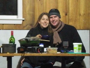
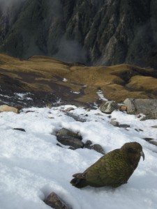
Our evening at the shelter making dinner, drinking wine, and packing was perfect preparation for our sunrise departure up Avalanche Peak. We made it to the bushline just as light was filling the valley and got peephole views across to the waterfall and up to higher peaks. As we climbed higher and higher, the trail became more gnarly and intense. I often felt like I was back in the Andes, carefully picking my way along the razorback of a ridgeline, glancing an the thousand foot drops six inches on either side. Woooo!!! The views were EPIC. At the very top, we reluctantly sacrificed the last 100 yards to ice covered climbing surfaces (you’re welcome, Mom). The Kea, the world’s only alpine parrot, made frequent appearances throughout the day, including a showstopping display during our almost-summit lunch. So curious and fun to watch!
We didn’t expect to be down the mountain until after dark, but we made record time AND had a moment of brilliance at the bottom: we can make the 6p.m. beer tour at Monteith’s! The tour, as far as knowledge expansion goes, was an utter fail. Paul (?) was a retired butcher who was NOT INTERESTED in doing anything but repeating verbatim his usual tour. It was just us and a couple from the east coast (U.S.). Each time the poor woman asked a question, Paul would respond, “We’ll get to that later.” He officially earned the “Worst Tour Ever” award when we found the beer tastings to be measly little squirts of their entirely mediocre line of beer. The saving grace was Paul’s clarification on meat cuts and the tip to make pumpkin wine by adding water and champagne yeast to a hollowed out jack-o-lantern! Wedding novelty?
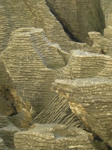
After one last night sleeping on the streets of Greymouth (in the van), we got up with the sun to see the Pancake Rocks and Blowhole up north at Punakaiki (Poo-nuh-k-eye-kee). Somehow layers of marine creatures had become compressed between layers of hard rock. Layer A errodes faster than layer B, leaving an awesome every-other pattern in the towers of exposed formations. After a half-hearted wander at an almost-cave, we took the stroll down to Tasman Bay and enjoyed a cool secluded little beach.
Westport — the last major town on the northwest coast — was our lunchtime break. We strolled around the town and happened upon a brewery (fate?!. After tasting, they pointed us in the direction of the “best fish and chips” — and they were! We had to partake in this national dish at least once. Not for those without a strong stomach, but delicious! Then we wound our way up through the rainforest and down the other side to reach Karamea — the last stand on the northern west coast. We bumped down a gravel road for an hour and hiked along a trail for 20 minutes before happening upon the Oparara Arch — the longest, biggest, best… blah, blah, blah. It was impressive, but so were the caves up the road! We hunkered under a picnic shelter to pack our bags for our Wangapeka track journey the following day and make dinner, and the wekas kept us company all night! Another successful thread on an ongoing journey. Woot!
See hilarious NZ road warning signs, ancient cave formations, a sock making machine, and a gnarly spider nest by clicking here.


Twitter Facebook Google+ StumbleUpon Reddit Pinterest